818: REVISITING DOKLAM: FROM STANDOFF TO STRATEGIC CONTEST


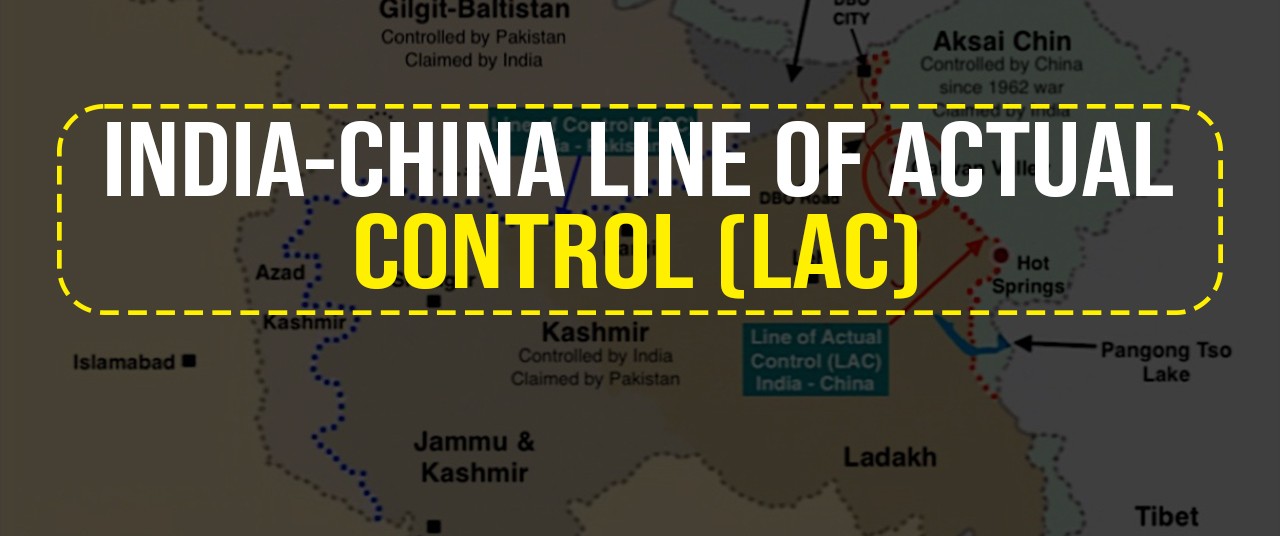
In 2017, India and China had the most dangerous bilateral confrontation since 1962 at the Doklam Plateau. Disengagement took place after a 73-day standoff. The face-off ended without a formal agreement or any resolution of the underlying territorial contest. Both sides claimed a measure of satisfaction. India had stopped the road. China had not been forced to concede anything publicly. Seven years later, the situation has taken an entirely different direction.  From a temporary military standoff, it has become a permanent grey-zone contest in which the instruments of Chinese pressure are increasingly civilian, infrastructural, and juridical rather than uniformed and kinetic. Understanding what has happened at Doklam since 2017, what China is now doing in the Amo Chu Valley, and what India must do in response is not an exercise in historical analysis. It is the most pressing operational and strategic question facing India’s eastern defence architecture in 2026.


Indian Redline. A specific act at a specific location triggered the 2017 standoff.  Chinese road construction at a point on the Doklam plateau where the road, if completed, would have given the People’s Liberation Army direct vehicular access to the Jampheri Ridge. That ridge is the dominant high ground overlooking the Siliguri Corridor. The corridor is a narrow strip of Indian territory, barely 22 kilometres wide at its narrowest, that constitutes the sole land link between the northeastern states and the Indian mainland. Control of the Jampheri Ridge does not merely threaten the Siliguri Corridor; it commands it. Artillery or missiles positioned there can interdict the Corridor without crossing into Indian territory.


Post 2017 Changes.

Alternate Road. What India stopped in 2017 was a road to a specific point via a specific route. What China has since done is build a different road to the same strategic destination. Satellite imagery analysed by multiple independent research organisations confirms that China has completed a road approximately 5 kilometres long through the Amo Chu Valley. The route has been redesigned to circumvent the specific location of India’s red line rather than to challenge it directly.  This road allows PLA forces and vehicles to approach the Jampheri Ridge area without crossing the precise point where Indian troops halted Chinese construction in 2017. The strategic objective of access to the high ground above the Siliguri Corridor remains unchanged. 

Demographic Alteration. The Amo Chu road is the kinetic component of a broader strategy, the most significant element of which is the construction of permanent settlements. China’s Xiaokang village programme has placed villages in strategically selected locations (previously uninhabited or seasonally used by Tibetan herders) across the Himalayan frontier. They have been created to establish a permanent Chinese presence. Continuous occupation supports territorial claims under international norms. These villages are not primarily civilian in purpose, irrespective of their formal designation. These settlements house border defence forces alongside civilian residents. They are connected by road infrastructure that provides the PLA with access and logistics. And they are designed to make any Indian military response to Chinese encroachment diplomatically and legally costly, because attacking or displacing a civilian settlement carries international consequences that interdicting a military road column does not. In the Doklam area, the village of Pangda, situated in the Amo Chu Valley, is the most significant of these.


Indian Options

The appropriate Indian response to the situation at Doklam is not a military operation. It is the construction of a comprehensive active deterrence architecture that operates across the same grey-zone spectrum that China is exploiting, while reinforcing the conventional deterrent that limits China’s escalatory options. This architecture has several components.

Military Bases to Hardening the Chicken’s Neck. The Siliguri Corridor’s strategic vulnerability is a serious problem. Still, it can be substantially mitigated through layered defensive depth. The completion of the Lachit Borphukan Military Station at Dhubri, combined with new military stations at Chopra and Kishanganj, would provide overlapping defensive coverage across the approaches to the Corridor from multiple directions simultaneously. These stations would create a defence-in-depth.  The stations would also provide forward basing for the UAV, electronic warfare, and air defence assets that active deterrence in this theatre requires.

Military Technology Utilisation. China’s principal tactical advantage in the Chumbi Valley is logistical.  The road network and infrastructure investment that gives the PLA the ability to position and sustain significant forces in terrain where India’s own logistics are comparatively constrained. The answer is making that logistics infrastructure a liability rather than an asset. The deployment of advanced surface-to-air missile systems (S-400), supplemented by the Rafale’s organic electronic warfare capability and the Su-30MKI’s air-to-air performance, would provide an asymmetric advantage.   The A2AD architecture is not merely about shooting down aircraft; it is about denying China the confident expectation of air superiority that any escalation to conventional conflict would require.

Demographic Counter. The most direct counter to China’s Xiaokang village strategy is India’s own Vibrant Villages Programme. Chinese villages in border areas serve military functions precisely because they are permanently inhabited. India’s border hamlets in Sikkim and Arunachal Pradesh, many of which have experienced significant depopulation as residents migrate to urban centres for economic opportunity, present the opposite picture. The Vibrant Villages Programme aims to reverse the trend. A Combination of 5G connectivity, all-weather roads, economic incentives, and livelihood support is designed to reverse this depopulation. Permanently inhabited Indian villages along the Sikkim and Arunachal borders would assert Indian sovereignty and serve as a HUMINT asset.  The pace of the programme’s implementation must be accelerated.

Tourism as Sovereignty. The relationship between civilian presence and territorial claim is well established in international practice, and India has underutilised the tourism instrument as a form of continuous sovereign assertion. Tourism is not merely an economic activity. Active promotion of border tourism (facilitated by improved road connectivity, accommodation infrastructure, and streamlined permit processes) would create a continuous civilian presence that directly challenges any claims of vacant territory. Tourism is also a form of territorial assertion that is simultaneously visible, documentable, and internationally legitimate.

Deepening the Bhutanese Engagement. The India-Bhutan relationship is crucial. In 2021, China proposed resolving the broader Bhutan boundary dispute through a “three-step roadmap”.  It was Beijing’s strategy of using Bhutan-China bilateral negotiations to achieve favourable outcomes while circumventing Indian involvement. India’s response must go beyond security assurances and treaty obligations. A Bhutan that is economically prosperous and strategically confident is a far more resilient partner in resisting Chinese pressure than a Bhutan that perceives its security relationship with India as its only alternative to accommodation with Beijing.

AI-Driven ISR to Counter Grey-Zone Activities.  The central operational weakness that grey-zone salami-slicing exploits is the gap between periodic observation and continuous surveillance. Patrolling schedules, satellite revisit intervals, and human intelligence collection cycles all create windows of unobserved time during which incremental changes can be made and completed before India’s intelligence system registers them. By the time the change is observed, it is a fact on the ground. Contesting it requires either the military action that grey-zone methodology is designed to deter or acceptance of the new reality. The answer lies in eliminating the observational gaps through AI-driven continuous monitoring. AI-assisted change-detection processing applied to the continuous imagery feed identifies variations in the physical landscape within hours of their occurrence, rather than days or weeks. This is the single most important capability investment India can make in this theatre.

Digital Border Ledger. China’s grey-zone methodology depends on narrative ambiguity.  The counter to narrative ambiguity is documented transparency. The answer lies in a publicly accessible Digital Border Ledger. A regularly updated database of satellite evidence showing Chinese construction activity, vegetation clearance, road extension, and settlement development along the LAC and the Bhutan-China boundary, with time-stamped imagery and geographic coordinates, would transform the information environment in which Chinese grey-zone operations proceed. A systematic publication of such documents would counter Beijing’s deniability.


Concluding Thoughts

The Doklam plateau is a strategic red line for India, as it overlooks the Siliguri Corridor. Chinese activities in the Chumbi Valley, such as the making of Amo Chu Road and the establishment of Pangda Village, are not isolated actions. They are part of a deliberate strategy to incrementally improve China’s position on the high ground. India’s answer must be equally patient, persistent, and multi-dimensional.

The prevention that worked at Doklam in 2017 was the product of decisions made years before the standoff. Forward basing decisions, ISR investments, force posturing, and treaty relationships that were in place when the crisis arrived. The deterrence required at Doklam in the years ahead must be built now, before the next crisis defines the terms of the contest.


Please Add Value to the write-up with your views on the subject.


1924
Default rating

Please give a thumbs up if you  like The Post?


For regular updates, please register your email here:-

Subscribe


References and credits

To all the online sites and channels.

Pics Courtesy: Internet

Disclaimer:

Information and data included in the blog are for educational & non-commercial purposes only and have been carefully adapted, excerpted, or edited from reliable and accurate sources. All copyrighted material belongs to the respective owners and is provided only for wider dissemination.


817: HISTORICAL PERSPECTIVE ON THE INDIA–CHINA BOUNDARY DISPUTE


(The line that was never agreed upon)


Stretching from the Karakoram ranges in the west to the forested hills of Arunachal Pradesh in the east (approximately 3,488 kilometres) is the boundary between India and China, which occupies Tibet. It is not a border that was drawn, agreed upon, demarcated, and then disputed. It is a frontier that was never fully settled in the first place. It is a line that exists, as a matter of competing cartographic assertions rooted in imperial history, post-colonial nationalism, and unresolved strategic calculation.

To understand why Indian and Chinese soldiers confronted each other with lethal consequences at Galwan in June 2020, one must go back not merely decades but centuries. The boundary dispute is, at its core, a collision between the territorial inheritance of the British Indian Empire, the historical assertions of Imperial China, the revolutionary confidence of the People’s Republic of China, and the aspirational sovereignty of independent India. All of these forces remain alive in the dispute today.


Genesis of the Problem

The problem did not exist till the nineteenth century. It became one as the British Empire pushed its frontiers toward the Himalayas. British India’s interest in the Himalayan frontier was driven primarily by the strategic competition with Tsarist Russia for influence over Central Asia. A clearly defined, defensible northern frontier was a British strategic imperative. From the 1860s onward, British surveyors, explorers, and political officers pushed into Ladakh, Sikkim, and the northeastern frontier with the dual purpose of mapping the terrain and establishing the reach of British Indian sovereignty.

The critical complication was Tibet. Britain’s preferred outcome was a Tibet autonomous enough to serve as a buffer against Russian or Chinese encroachment, but within a broad sphere of British influence. The 1904 Younghusband Expedition to Lhasa was an expression of this policy. It was an extraordinary and controversial mission that forced a treaty on the Tibetan government.

The Qing dynasty’s response was to reassert direct control over Tibet, sending military expeditions in 1910 that briefly occupied Lhasa and forced the Dalai Lama into exile in British India. The Qing’s collapse in 1911 reversed this, and Tibet declared independence (not recognised by China).  The genesis of the boundary dispute lies in the status of Tibet. Tibet’s boundaries with British India were precisely the boundaries that India inherited in 1947, and that China refused to accept when it absorbed Tibet in 1950.


Colonial Cartographic Legacy

The Western Sector: Aksai Chin. Aksai Chin is a high-altitude desert plateau roughly the size of Switzerland, sitting at the intersection of Ladakh, Tibet, and Xinjiang. It is one of the most inhospitable places on earth. The boundary in this sector was never formally agreed upon between British India and either the Qing dynasty or, subsequently, the Republic of China. Different alignment proposals emerged from the British period, each reflecting different strategic priorities, none the product of bilateral agreement.

    • Johnson Line of 1865. Civil servant W.H. Johnson formulated it and was later modified by Major General John Ardagh. It placed the entire Aksai Chin plateau inside Jammu and Kashmir by extending the boundary northward to the Kunlun Mountains. It is the historical basis for India’s modern territorial claim.
    • Macartney-MacDonald Line of 1899. It was proposed to the Qing government by Sir Claude MacDonald. The British strategic priorities had shifted toward conciliating China against Russia. It proposed that the Karakoram range be used as the frontier and that most of Aksai Chin be placed under Chinese administration. The Qing government never formally responded to this proposal. China now asserts by it.

The Eastern Sector. The eastern sector’s origins lie in the Simla Convention of 1914, a tripartite conference among British India, Tibet, and the Republic of China. The British representative, Sir Henry McMahon, negotiated directly with Tibetan representatives and, through an exchange of notes, established a boundary between British India and Tibet running along the highest ridgeline of the eastern Himalayas. This alignment, known as the McMahon Line, ran approximately 890 kilometres from the Bhutan border eastward to the bend of the Brahmaputra and placed approximately 90,000 square kilometres of territory, now the state of Arunachal Pradesh, within British India. The Chinese representative at Simla initialled the convention but refused to formally ratify it, objecting both to the proposed internal division of Tibet into Inner and Outer zones and to the fundamental premise that Tibet possessed the sovereign authority to conclude treaties independently of China. China has consistently maintained that the McMahon Line is illegal as it was negotiated without the Chinese consent. China refers to Arunachal Pradesh as “South Tibet” or Zangnan, with particular emphasis on the town of Tawang, which carries deep religious and historical significance as a major centre of Tibetan Buddhism. India considers the McMahon Line as a valid international boundary.


Post-Colonial Differences (1947 to 1959)

India’s independence in 1947 and the establishment of the People’s Republic of China in 1949 initially produced not confrontation but an era of proclaimed Asian solidarity. India was among the first non-communist countries to recognise the People’s Republic. Hindi-Chini Bhai-Bhai was the slogan of the early 1950s. It reflected Jawaharlal Nehru’s genuine belief in Asian cooperation as the organising principle of post-colonial international relations.

The geopolitical cushion between the two countries vanished in 1950 when the Chinese People’s Liberation Army entered Tibet. India had historically viewed Tibet as an autonomous cultural buffer state with which it shared deep spiritual and trade connections. China’s absorption of Tibet transformed that buffer into a direct shared frontier of over 3,500 kilometres, and border ambiguity became a strategic security issue of the first order.

The Panchsheel agreement of 1954 between Nehru and Zhou Enlai embedded the Five Principles of Peaceful Coexistence. The two leaders jointly championed it as the framework for a new Asian order. What the agreement also did, critically, was recognise Chinese sovereignty over Tibet without resolving the boundary question. In retrospect, India traded its strongest diplomatic card (the legal ambiguity of Tibet’s status) for a set of principles without securing a boundary settlement in exchange.

Two developments then shattered the remaining foundations of the relationship. First was the 1957 discovery of the Chinese road through Aksai Chin. It was built entirely across territory India considered its own, and completed without India’s knowledge.  Second, the Tibetan uprising of 1959 and the subsequent flight of the Dalai Lama to India, where he was granted political asylum, fundamentally fractured bilateral trust. Beijing interpreted India’s action as active interference in its internal sovereignty and as an attempt to subvert Chinese consolidation of Tibet. The period of brotherhood was over.

In 1959, Chinese Premier Zhou Enlai put forward a proposal that would prove a pivotal missed moment: China would recognise the McMahon Line in the east if India accepted Chinese claims over Aksai Chin in the west. Nehru rejected the offer. It was also in 1959 that Zhou Enlai first used the term “Line of Actual Control” in a letter to Nehru, defining it as the line up to which each side exercised actual control.


War Over the Dispute

In an attempt to check further Chinese advances without provoking all-out conflict, Prime Minister Nehru instituted the “Forward Policy” in late 1961. India established small military outposts in disputed areas. Beijing interpreted this not as a defensive manoeuvre but as a continuation of British-style forward expansionism into the Tibetan borderlands.

The Sino-Indian War of October to November 1962 is a significant event. On 20 October 1962, the People’s Liberation Army launched simultaneous offensives across both the Western and Eastern Sectors. The Indian forces were overwhelmed. In the east, Chinese forces advanced deep, nearly reaching the plains of Assam. In the west, they consolidated their hold over Aksai Chin.

On 21 November 1962, China declared a unilateral ceasefire and withdrew its troops twenty kilometres behind what it defined as the Line of Actual Control in the Eastern Sector, but maintained its positions in Aksai Chin. The war facts on the ground that persist to the present day are that China controls Aksai Chin, and India administers Arunachal Pradesh. Neither country has accepted the other’s position. The Line of Actual Control (the de facto boundary that emerged from the ceasefire) remains undefined, undemarcated, and contested in multiple sectors. Unlike the Line of Control with Pakistan, there is no formal agreement on its location.


Renewed Assertion

Sumdorong Chu standoff.  The issue remained dormant for almost two and a half decades till 1986. The Sumdorong Chu standoff of 1986 to 1987 in the Tawang region of the Eastern Sector was a serious post-1962 confrontation. A Chinese detachment occupied a valley traditionally grazed by Indian herders, triggering a massive military build-up on both sides that brought the nations to the brink of another war before diplomatic intervention defused the situation.

The Protocol Architecture.  The 2013 Border Defence Cooperation Agreement established institutionalised hotlines and joint mechanisms to manage face-offs and prevent their escalation. This architecture rested on a set of shared understandings. It encompassed that the boundary dispute would be kept separate from the overall relationship, that economic interdependence would create incentives for stability, and that neither side would seek to alter the status quo by force. For roughly two decades, the framework held. Standoffs occurred at Depsang in 2013 and Chumar in 2014, but were managed and defused within the established protocols.

Doklam Standoff. The framework began showing serious structural stress with the Doklam standoff of 2017, when Indian and Chinese troops confronted each other for 73 days on a plateau near the Bhutan-China-India trijunction. India intervened against Chinese road construction that it regarded as a direct threat to the strategic Siliguri Corridor, also called the Chicken’s Neck. The standoff ended without a clear resolution but signalled a new Chinese willingness to test Indian redlines and a meaningfully changed strategic posture.

Galwan Clash. On the night of 15 June 2020, Indian and Chinese soldiers clashed in the Galwan Valley in Eastern Ladakh.  It caused fatalities on the Line of Actual Control in 45 years.  The clash was not a spontaneous skirmish but the violent consequence of Chinese infrastructure construction across multiple friction points in Eastern Ladakh, systematically altering the status quo. Galwan shattered the diplomatic architecture built over three decades and triggered the gravest rupture in India-China relations since 1962.


Insolvability Drivers

The Tibet factor. This factor remains structurally central. India’s fundamental position is that it inherited a valid boundary from its colonial predecessor. The Tibetan government’s legal authority at the time of the Simla Convention had endorsed the Simla Convention. China’s fundamental anxiety is that international legitimisation of the McMahon Line would imply that Tibet possessed the sovereign authority to conclude treaties.

Dispute Asymmetry.  means that the two sides are not exchanging equivalent concessions. China’s primary strategic interest is in Aksai Chin, which it already controls and which is essential for connecting Xinjiang to Tibet via the G219 highway. India’s primary claim is to Arunachal Pradesh, which India already administers. The logical resolution would require India to formally abandon its claim to Aksai Chin and China to formally renounce its claim to Arunachal Pradesh. Neither government has found the domestic political space to make that concession, and no leader on either side has been willing to bear the political cost of being seen as the one who gave territory away.

The Shifting Balance of Power.  This reduces China’s incentive to settle on terms India could accept. In 1988, when the framework of managed competition was established, the two economies were roughly comparable in size. Today, China’s economy is approximately five times larger than India’s, and its military modernisation has outpaced India’s by a significant margin. From Beijing’s perspective, time and the correlation of forces are on its side. Settling now, on terms of rough equivalence, would mean forfeiting the strategic advantages.


Line Awaiting Resolution

The dispute has outlived the Bhai-Bhai idealism, the 1962 war, decades of diplomatic engagement/confrontation, the Cold War, and multiple generations of leaders on both sides. The line that was never agreed upon remains a source of danger, distrust, and unfinished history. It awaits a political moment when leaders are willing to trade the ambiguity of the present for the clarity that resolution alone can provide. That moment is still awaited more than six decades after the war that defined the modern shape of the dispute.


Please Add Value to the write-up with your views on the subject.


1924
Default rating

Please give a thumbs up if you  like The Post?


For regular updates, please register your email here:-

Subscribe


References and credits

To all the online sites and channels.

Pics Courtesy: Internet

Disclaimer:

Information and data included in the blog are for educational & non-commercial purposes only and have been carefully adapted, excerpted, or edited from reliable and accurate sources. All copyrighted material belongs to the respective owners and is provided only for wider dissemination.


References:


Lamb, A. (1964). The China-India border: The origins of the disputed boundaries. Oxford University Press.

Lamb, A. (1973). The Sino-Indian border in Ladakh. Australian National University Press.

Garver, J. W. (2001). Protracted contest: Sino-Indian rivalry in the twentieth century. University of Washington Press.

Garver, J. W. (2011). The unresolved Sino-Indian border dispute: An interpretation. China Report, 47(2), 99–113.

Lintner, B. (2018). China’s India war: Collision course on the roof of the world. Oxford University Press.

Menon, S. (2016). Choices: Inside the making of India’s foreign policy. Brookings Institution Press.

Menon, S. (2021). India and Asian geopolitics: The past, present. Brookings Institution Press.

Raghavan, S. (2010). War and peace in modern India: A strategic history of the Nehru years. Permanent Black.

Hoffmann, S. A. (1990). India and the China crisis. University of California Press.

Shakya, T. (1999). The dragon in the land of snows: A history of modern Tibet since 1947. Columbia University Press.

Goldstein, M. C. (1989). A history of modern Tibet, 1913–1951: The demise of the Lamaist state. University of California Press.

Arpi, C. (2009). 1962 and the McMahon Line saga. Lancer Publishers.

Fravel, M. T. (2020). China’s changing approach to military coercion in territorial disputes. The Washington Quarterly, 42(3), 179–201.

816: Podcast on Sainik Welfare News


Had an Interesting Chat with Capt Lokendra Singh (Retd) on Sainik Welfare News Podcast.


We talked about:-

  1. The biggest lesson from the journey in service.
  2. Decision Making. 
  3. Role of Airpower in the maritime domain and IOR.
  4. Challenges in commanding a base.
  5. China’s airpower balance.
  6. Role of AF in the Doklam standoff.
  7. Strategic message from Balakot air strikes.
  8. Future of Manned fighter aircraft.
  9. Jointness and Integrated Operations.
  10. Qualities of a good military leader.
  11. The most risky and challenging flying.
  12. Balanced life.
  13. Flying training challenges.
  14. Role of technology in airpower
  15. Tejas Project.
  16. message to young aspirants.
  17. Most memorable aircraft to fly.
  18. Most memorable posting.
  19. Most impressionable book, person, or idea.
  20. Advice to your younger self.


Comments and Views are most Welcome.


1924
Default rating

Please give a thumbs up if you  like The Post?


For regular updates, please register your email here:-

Subscribe


References and credits

To all the online sites and channels.

Pics Courtesy: Internet

Disclaimer:

Information and data included in the blog are for educational & non-commercial purposes only and have been carefully adapted, excerpted, or edited from reliable and accurate sources. All copyrighted material belongs to the respective owners and is provided only for wider dissemination.


English हिंदी