

806: SPACE – THE NEW ARENA OF WARFARE


(Inputs to Questions)


Q1. Compressing the Sensor-to-Shooter Timeline

In today’s evolving warfare landscape, the true strength and deterrence now come from long-range strike weapons, unmanned systems, loitering munitions, airborne tankers, space-based ISR networks, and the collaboration between manned and unmanned systems. This shift in military strategy calls for a broader structural change. Delays in taking action are no longer just tactical setbacks; they become a significant strategic vulnerability.

The sensor-to-shooter timeline compression is not only a technological problem but also a fundamental issue in decision architecture. Compressing that timeline requires work in several areas.

First, satellites must carry onboard AI capable of detecting, classifying, and cueing targets.  They should be able to transmit actionable intelligence over tactical data links. This eliminates the round-trip to a ground station for analysis.

Second, pre-authorised engagement envelopes, i.e. defined target criteria against which strike authority is delegated to the satellite before conflict begins. A satellite can trigger an execution sequence rather than a consultation.

Third, a direct machine-to-machine network between ISR assets and strike platforms, with AI cross-referencing satellite data with other sensors (UAVs, SIGINT, and ground radars) to automatically produce a confidence-rated target package.

The legal and ethical concerns surrounding a misattributed strike are understandable, highlighting the importance of having a careful approach in the kill chain. It’s essential to keep the human in the loop, ensuring the human authorises each kinetic attack. While smart machines can identify and designate targets, human oversight remains a crucial safeguard.


Q2. Fighting Through the Electronic Fog

Fighting through the Fog of war has existed since wars began. Electronic fog is a part of it. In the future, assessments of the threat environment should treat GPS jamming and ISR spoofing as baseline assumptions in conflict scenarios. The opening moves of any conflict involve cyber and electronic attacks before any kinetic exchange. Electronic attack is now a feature of even ostensibly non-combat environments (IAF aircraft flying into earthquake-hit Myanmar faced GPS spoofing).

The response must be across three levels. At the platform level, the need is for integrated systems with multiple guidance modes (inertial navigation, terrain-referenced navigation, NavIC integration, and optical terminal guidance). so that loss of GPS does not render the platform/weapon ineffective. Multi-constellation receivers (combining NavIC, GLONASS, and Galileo) would force an adversary to jam multiple frequencies simultaneously. In the future, quantum computing will enable precise navigation without reliance on GPS. At the same time, the implementation of quantum cryptography will secure communications.

At the space segment level, satellites should be capable of operating in a degraded communications environment. Resilience must be built into the architecture from the outset. They need anomaly-detection capability, frequency agility and hardened electronics. Optical communication between satellites is one way of reducing RF vulnerability.

At the operational level, the goal is not to eliminate the electronic fog but to remain functional inside it. Combat personnel must train regularly in GPS-denied and communications-degraded environments. Spectrum-agile systems, low-probability-of-intercept communications, and redundant networks are required to counter EW threats. Redundancy in sensors, communications, and commanders’ cognitive habits produces all-around resilience.


Q3. Distributed Constellations vs. Exquisite Satellites

The doctrine of “space deterrence” has become a key part of modern defence strategies. Protecting satellites through resilience and backups is now more important than ever. While a single valuable satellite can be a tempting target, having a group of smaller satellites spreads out the risk, making the overall system much sturdier. Each small satellite is less critical on its own, but together, they create a network that’s much harder to disrupt.

However, there are some trade-offs. Smaller satellites can carry smaller payloads. They have lower sensor resolution and have narrower per-node bandwidth. They may be suitable for tactical ISR functions, but insufficient for certain high-end ISR requirements. The practical answer is a tiered architecture. A mix of a small number of high-capability strategic satellites complemented by a larger constellation of capable, expendable ones.

Stratospheric airships present an exciting alternative! Operating comfortably at altitudes of 20–30 km, they blend the long-lasting qualities of satellites with the flexibility of terrestrial systems. Unlike geostationary satellites, airships can be moved, repaired, or upgraded with ease, allowing them to adapt to changing mission needs. The successful flight trial of DRDO’s stratospheric platform in May 2025 is a significant milestone. While these platforms won’t replace satellites, they offer a cost-effective addition to the overall surveillance setup.

India’s SBS-III programme, targeting 52 dedicated military satellites (equipped with SAR, electro-optical, and infrared payloads), is a step in the right direction. The involvement of private industry in a significant portion of those satellites signals an important shift toward faster production and greater cost efficiency.


Q4. Fusing Space Assets into a Common Operational Picture

The data fusion problem is a real challenge. Without integration, more sensors produce more confusion, rather than clarity. The challenge is to get the processed sensor data to the right person, in usable form, at the right time. It is more of an organisational and doctrinal issue than a technical one.

The information from space sensors must be fused into a single picture. The Common Operational Picture that a field commander can rely on must be continuously updated and remain current.  It needs AI-driven correlation engines that perform real-time multi-sensor fusion, with confidence scoring for each data element, so a commander knows not just what the picture shows but how much to trust it.  Building this requires common data standards across the IAF, the Army, the Navy, and the Defence Space Agency.  This is a foundational necessity.

The most critical single step is to establish a jointly manned Space and Intelligence Fusion Center. The center should have real-time data access, direct connectivity and the authority to produce an integrated assessment. In the current model, information from different agencies passes through separate chains before being reconciled at a higher level. It introduces a delay that defeats the purpose of persistent surveillance. AI-enabled networked solutions for data collection, analysis, planning, dissemination, and monitoring must sit at the heart of this center.


Q5. Responsive Space and Tactical Satellite Launch

Space is becoming more militarised, with countries developing anti-satellite weapons, directed-energy systems, and cyber tools to disrupt vital assets such as GPS, reconnaissance, and communications satellites. Countries that can quickly rebuild their space infrastructure during challenges enjoy a lasting edge over those that can’t.

Tactical gaps can arise during hostilities due to satellite attrition or new threat activity not accounted for in pre-conflict planning. The ability to task a launch in response to these situations is necessary. The concept needs a shift in mindset of viewing the space as a static strategic asset to a fluid manoeuvre domain. In the longer term, the vision of a field commander requesting coverage over a sector and receiving a dedicated satellite within 24 to 72 hours is both feasible and strategically significant.

Current launch timelines are measured in weeks or months, not hours. Closing that gap requires investment in small launch vehicles with rapid turnaround capability. India’s SSLV technology transfer to industry is a step in the right direction. A stock of ready-to-launch, pre-integrated satellites with modular payloads needs to be built up.  Launch infrastructure capable of supporting surge operations, including mobile or dispersed pad options, would also be required.

The more immediately achievable priority is responsive tasking of satellites already in orbit. The existing assets should be dynamically reprogrammable to cover a priority area at short notice. That is primarily a software and ground architecture problem and should be the near-term focus while launch responsiveness matures.

Please Add Value to the write-up with your views on the subject.


1971
Default rating

Please give a thumbs up if you  like The Post?


For regular updates, please register your email here:-

Subscribe


References and credits

To all the online sites and channels.

Pics Courtesy: Internet

Disclaimer:

Information and data included in the blog are for educational & non-commercial purposes only and have been carefully adapted, excerpted, or edited from reliable and accurate sources. All copyrighted material belongs to the respective owners and is provided only for wider dissemination.
 

712: EYES IN THE SKY: OPERATION SINDOOR SPURS INDIA’S SPACE DEFENCE SURGE


My Article was published in the “Life of Soldier”  Journal, Aug 25.


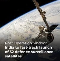
In the wake of Operation Sindoor, conducted from May 7 to 10, 2025, India has launched an ambitious mission to enhance its space-based defence capabilities. The operation, a retaliatory strike against terror camps in Pakistan following the devastating Pahalgam attack on April 22, 2025, underscored the critical need for “deep” and “persistent” surveillance over adversarial territories. This necessity has prompted India to accelerate the deployment of 52 dedicated defence satellites under the Space-Based Surveillance (SBS) Phase-3 programme, which was approved in October 2024 with a budget of Rs 26,968 crore. Coupled with the finalisation of a comprehensive military space doctrine, India is poised to transform its strategic surveillance and defence framework, reducing reliance on foreign assets.


The Catalyst: Operation Sindoor

Operation Sindoor was a pivotal moment in India’s defence strategy, highlighting both the strengths and limitations of its current surveillance capabilities. The operation targeted terror infrastructure in Pakistan-occupied territories, relying on satellite imagery from foreign providers. While these assets provided critical intelligence, the operation exposed India’s dependence on external sources for real-time, high-resolution imagery. This dependency posed risks, including delayed access to data and potential vulnerabilities in data security, especially during high-stakes military engagements.

The Pahalgam attack, which killed 29 people, including civilians and security personnel, revealed gaps in India’s ability to monitor cross-border activities with the granularity and persistence required for pre-emptive or retaliatory actions. The subsequent success of Operation Sindoor, while a tactical victory, emphasised the need for an indigenous, robust, and self-reliant space-based surveillance system. The operation’s reliance on foreign satellites underscored the urgency to develop a dedicated constellation capable of providing continuous, high-resolution coverage of strategic areas, including Pakistan, China, and the Indian Ocean Region (IOR).


The Space-Based Surveillance (SBS) Phase-3 Programme

The Indian government had approved the SBS Phase-3 programme in October 2024, allocating Rs 26,968 crore to deploy 52 defence satellites. This ambitious initiative, led by the Indian Space Research Organisation (ISRO) in collaboration with private industry, aims to establish a comprehensive space-based intelligence, surveillance, and reconnaissance (ISR) network by 2029. The programme is structured to leverage both public and private sector expertise, with ISRO tasked with launching 21 satellites and three private companies deploying the remaining 31. Key Features of the Programme are as follows:-


Satellite Constellation. The 52 satellites will operate in a mix of low Earth orbit (LEO) and geostationary orbit (GEO). LEO satellites, positioned at altitudes between 500 and 900 km, will provide high-resolution imagery (up to 0.3 meters), ideal for detailed monitoring of military installations, troop movements, and infrastructure. GEO satellites, stationed at 36,000 km, will provide continuous wide-area coverage, which is critical for tracking maritime activities in the IOR and monitoring large-scale developments along India’s borders.


Technological Capabilities. The satellites will be equipped with advanced synthetic aperture radar (SAR) and electro-optical sensors, enabling all-weather, day-and-night imaging. SAR systems are exceptionally vital for penetrating cloud cover and monitoring during adverse weather conditions, a frequent challenge in regions like the Himalayas. The constellation will also incorporate secure communication links to ensure real-time data transmission to ground stations and military command centers.


Public-Private Partnership. The involvement of private companies marks a significant shift in India’s space strategy. Companies like Tata Advanced Systems, Larsen & Toubro, and startups such as Pixxel and Skyroot Aerospace are expected to contribute to satellite manufacturing and launch services. This collaboration aims to accelerate deployment, reduce costs, and foster innovation in India’s burgeoning private space sector.


Timeline and Deployment.  The first satellite launch is scheduled for April 2026, with the entire constellation expected to be operational by 2029. The phased rollout will prioritise coverage of high-threat areas, including the Line of Actual Control (LAC) with China and the Line of Control (LoC) with Pakistan, before expanding to broader regional surveillance.


Strategic Imperatives

The SBS Phase-3 programme is driven by India’s need to counter growing regional security challenges. China’s expansive space program, with over 1,000 satellites, including advanced ISR and anti-satellite (ASAT) capabilities, poses a significant threat. Beijing’s ability to disrupt or destroy satellites, demonstrated by its 2007 ASAT test, underscores the need for India to develop resilient and redundant space assets. The People’s Liberation Army (PLA) has integrated space-based ISR into its military doctrine, enabling precise targeting and real-time battlefield awareness, as seen in its activities along the LAC.

Pakistan, while less advanced in space technology, relies on Chinese support for its satellite capabilities, including the Pakistan Remote Sensing Satellite (PRSS-1). The growing China-Pakistan nexus necessitates enhanced surveillance to monitor joint military exercises, infrastructure development (e.g., the China-Pakistan Economic Corridor), and potential terror activities emanating from Pakistani territory.

The IOR, a critical maritime domain, is another focus area. With China’s increasing naval presence and the strategic importance of chokepoints like the Malacca Strait, India requires persistent surveillance to safeguard its maritime interests and counter piracy, smuggling, and hostile naval operations.


Complementary Initiatives: HAPS and Beyond

In addition to the satellite programme, the Indian Air Force (IAF) is pursuing three high-altitude platform systems (HAPS) aircraft to complement space-based ISR. These solar-powered, unmanned platforms, operating at altitudes of 18-20 km, can remain airborne for weeks, providing persistent surveillance over specific areas. HAPS aircraft are particularly suited for monitoring border regions and can serve as a cost-effective alternative to satellites for localised ISR missions.

The IAF is also exploring the integration of artificial intelligence (AI) and machine learning (ML) to process vast amounts of satellite data. AI-driven analytics can identify patterns, detect anomalies, and provide actionable intelligence in real time, enhancing India’s ability to respond to threats swiftly.


Challenges and Opportunities

While the SBS Phase-3 programme and the military space doctrine represent a significant leap forward, challenges remain. The ambitious timeline requires seamless coordination between ISRO, private companies, and the military, which could face delays due to technical complexities or funding constraints. The private sector’s relative inexperience in defence-grade satellite manufacturing may also pose risks to quality and reliability.

Moreover, the global space environment is increasingly contested, with space debris and ASAT threats complicating satellite operations. India must invest in space situational awareness (SSA) capabilities to monitor and mitigate these risks. International norms on space militarisation, which are still in their infancy, could also impact India’s plans, necessitating diplomatic efforts to safeguard its interests.

On the opportunity front, the programme positions India as a significant space power, fostering technological innovation and economic growth through the private space sector. The public-private partnership model could serve as a blueprint for future defence projects, reducing costs and enhancing efficiency. Additionally, the doctrine’s focus on international cooperation opens avenues for technology transfers and strategic alliances, strengthening India’s geopolitical standing.


Conclusion

Operation Sindoor served as a wake-up call for India, highlighting the indispensable role of space-based surveillance in modern warfare. The SBS Phase-3 programme, with its 52 dedicated defence satellites, and the forthcoming military space doctrine mark a transformative step toward self-reliance and strategic dominance in the space domain. By addressing regional threats, leveraging public-private partnerships, and integrating advanced technologies like HAPS and AI, India is poised to secure its borders, maritime interests, and national security.


Please Add Value to the write-up with your views on the subject.


1971
Default rating

Please give a thumbs up if you  like The Post?


For regular updates, please register your email here:-

Subscribe


References and credits

To all the online sites and channels.

Pics Courtesy: Internet

Disclaimer:

Information and data included in the blog are for educational & non-commercial purposes only and have been carefully adapted, excerpted, or edited from reliable and accurate sources. All copyrighted material belongs to respective owners and is provided only for wider dissemination.


References:-


  1. Times of India (ToI). (2025). “India to Fast-Track 52 Defence Satellites After Operation Sindoor.”
  2. Indian Space Research Organisation (ISRO). (2024). “Space-Based Surveillance Phase-3 Programme Overview
  3. Ministry of Defence, Government of India. (2024). “Approval of Rs 26,968 Crore for Defence Satellite Programme.” Press Release, October 2024.
  4. Defence Space Agency (DSA). (2019). “Mission Shakti and India’s Anti-Satellite Capabilities.” Government of India.
  5. Jane’s Defence Weekly. (2025). “India’s High-Altitude Platform System (HAPS) Acquisition for ISR Missions.”
  6. Stockholm International Peace Research Institute (SIPRI). (2024). “China’s Space Programme and Anti-Satellite Capabilities.” SIPRI Yearbook 2024.
  7. Observer Research Foundation (ORF). (2025). “India’s Military Space Doctrine: A Strategic Roadmap.”
  8. The Hindu. (2025). “Operation Sindoor: India’s Response to Pahalgam Attack.” May 12, 2025.
  9. SpaceNews. (2024). “India’s Private Space Sector: Emerging Players in Defence Satellite Manufacturing.”
  10. Center for Strategic and International Studies (CSIS). (2024). “Space Situational Awareness and the Contested Space Environment.”
English हिंदी