677: NISAR: MAPPING THE FUTURE AND REVOLUTIONISING CLIMATE AND DISASTER INTELLIGENCE


My article was published in the Jun edition of the

News Analytics Journal


In an era where climate change, natural disasters, and ecological degradation are becoming more pressing global concerns, advanced space-based Earth observation has emerged as a vital tool. The NASA-ISRO Synthetic Aperture Radar (NISAR) mission is a landmark collaboration between the National Aeronautics and Space Administration (NASA) and the Indian Space Research Organisation (ISRO).

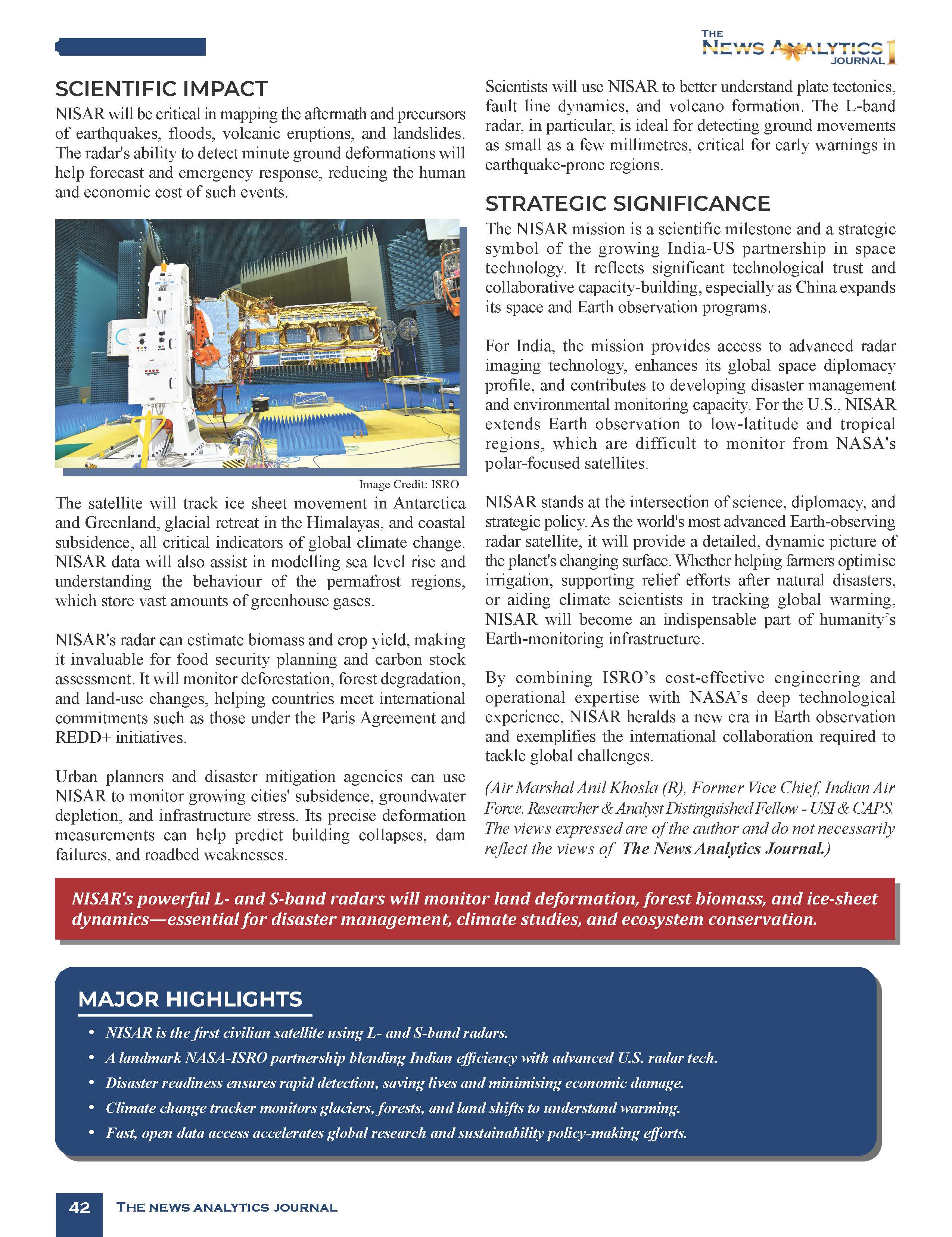
NISAR represents the most advanced dual-frequency radar satellite ever developed for civilian use. Once operational, NISAR will monitor Earth’s land and ice surfaces with high precision. It will capture surface movements down to fractions of an inch, aiding in studying tectonic shifts, glacier dynamics, forest health, and infrastructure stability.​ It can transform how we understand and respond to changes on Earth’s surface, ranging from glacial movements to forest biomass, from seismic activity to urban land subsidence.

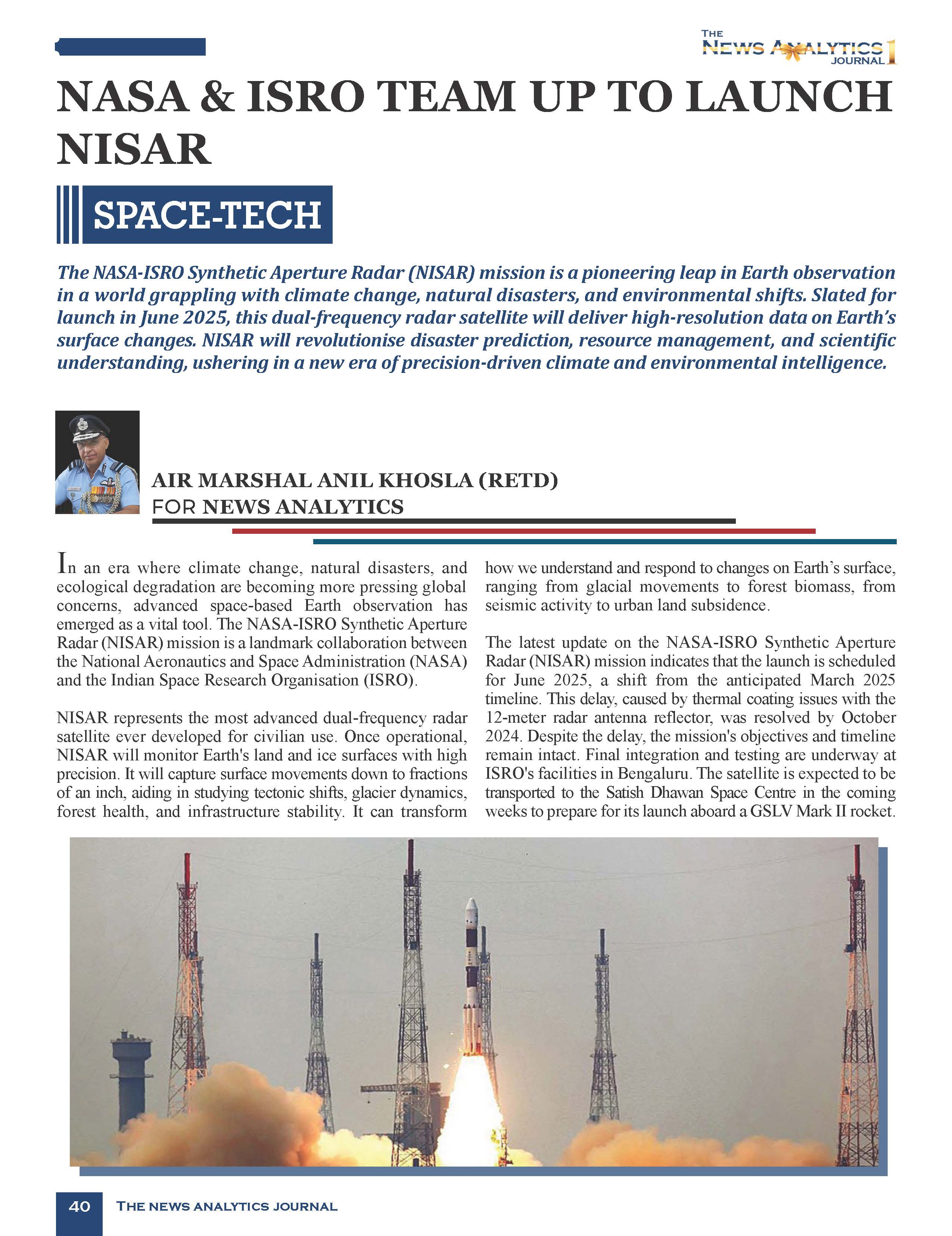
The latest update on the NASA-ISRO Synthetic Aperture Radar (NISAR) mission indicates that the launch is scheduled for late May to June 2025, a shift from the anticipated March 2025 timeline. This delay, caused by thermal coating issues with the 12-meter radar antenna reflector, was resolved by October 2024. Despite the delay, the mission’s objectives and timeline remain intact. Final integration and testing are underway at ISRO’s facilities in Bengaluru. The satellite is expected to be transported to the Satish Dhawan Space Centre in the coming weeks to prepare for its launch aboard a GSLV Mark II rocket.​


NISAR Project: Collaborative Effort


Genesis. The NISAR mission concept emerged from NASA’s 2007 Decadal Survey, which called for advanced SAR data to address gaps in Earth science. Formalised in 2014 with a partnership agreement, the project has progressed through rigorous design, testing, and integration phases. NASA’s Jet Propulsion Laboratory (JPL) and ISRO’s Space Applications Centre have worked closely to refine the mission’s science plan and hardware.

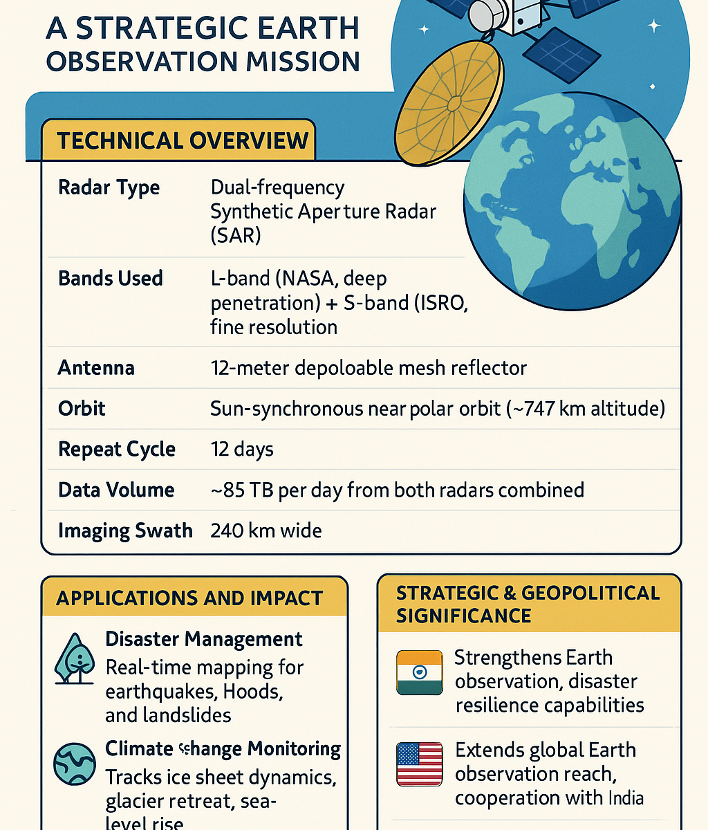
Project Details. The NISAR mission is designed to provide unprecedented global radar imagery using L-band and S-band synthetic aperture radars. NASA has provided the L-band radar system, high-rate communication subsystem, GPS receivers, and payload data systems. ISRO is contributing the S-band radar, satellite bus, and launch services via the GSLV Mk II from the Satish Dhawan Space Centre. The satellite will be placed in a sun-synchronous polar orbit at about 747 kilometres and revisit the exact location on Earth every 12 days. The SAR payload will produce radar images with a resolution of 5–10 meters and a swath of 240 kilometres, enabling wide-area monitoring of Earth’s surface with high precision. The unique dual-band system of NISAR allows it to penetrate vegetation, ice, and soil more accurately than single-frequency satellites, making it a game-changer in Earth observation. The L-band is particularly effective for tracking subsurface movement and biomass, while the S-band is more sensitive to finer surface features.

Collaboration. The NISAR partnership exemplifies international cooperation in space exploration. NASA’s investment, estimated at $1.118 billion, covers the L-band radar and critical subsystems, while ISRO’s contribution, approximately ₹788 crore ($92 million), includes the S-band radar, spacecraft bus, and launch services. This division of responsibilities optimises costs and expertise, building on NASA’s legacy of SAR missions (e.g., SEASAT in 1978) and ISRO’s advancements in satellite technology (e.g., the Chandrayaan missions). The collaboration extends beyond hardware. Joint workshops, working groups, and the NISAR Utilisation Programme announced by ISRO in July 2023 engage the global scientific community, fostering data analysis and application development. The mission’s open data policy aligns with the principles of transparency and collaboration, setting a precedent for future NASA-ISRO endeavours, including potential Mars exploration missions.


Mission Objectives and Scientific Impact

NISAR’s primary goal is to make global measurements of land surface changes, detecting movements as small as a centimeter. By mapping the globe every 12 days, the satellite will generate spatially and temporally consistent data, offering insights into complex Earth processes. Its objectives span three key domains: deformation, ecosystem structure, and ice dynamics. NISAR will monitor seismic zones, volcanic activity, and landslide-prone areas for deformation, providing early warning signs for natural disasters. In ecosystem studies, it will track forest extent, vegetation biomass, and agricultural patterns, aiding sustainable resource management. NISAR will measure glacier flow rates and ice-sheet stability for ice dynamics, contributing to our understanding of climate change and sea level rise.

All NISAR data will be freely available within one to two days of observation or hours for emergencies like natural disasters. This accessibility and NISAR’s high-resolution imagery (5-10 meters) will empower scientists, policymakers, and disaster response teams worldwide. The data can enhance infrastructure monitoring, improve agricultural management, and inform rapid disaster response, potentially saving lives and property. The open data policy also encourages collaboration and innovation, allowing for the development of new applications and tools to further leverage NISAR’s capabilities.


Applications

Natural Disaster Monitoring and Response. NISAR will be critical in mapping the aftermath and precursors of earthquakes, floods, volcanic eruptions, and landslides. The radar’s ability to detect minute ground deformations will help forecast and emergency response, reducing the human and economic cost of such events.

Climate Change Observation. The satellite will track ice sheet movement in Antarctica and Greenland, glacial retreat in the Himalayas, and coastal subsidence, all critical indicators of global climate change. NISAR data will also assist in modelling sea level rise and understanding the behaviour of the permafrost regions, which store vast amounts of greenhouse gases.

Agriculture and Forestry. NISAR’s radar can estimate biomass and crop yield, making it invaluable for food security planning and carbon stock assessment. It will monitor deforestation, forest degradation, and land-use changes, helping countries meet international commitments such as those under the Paris Agreement and REDD+ initiatives.

Urban Infrastructure Monitoring. Urban planners and disaster mitigation agencies can use NISAR to monitor growing cities’ subsidence, groundwater depletion, and infrastructure stress. Its precise deformation measurements can help predict building collapses, dam failures, and roadbed weaknesses.

Scientific and Tectonic Research. Scientists will use NISAR to understand better plate tectonics, fault line dynamics, and volcano formation. The L-band radar, in particular, is ideal for detecting ground movements as small as a few millimetres, critical for early warnings in earthquake-prone regions.

Strategic Significance

The NISAR mission is a scientific milestone and a strategic symbol of the growing India-US partnership in space technology. It reflects significant technological trust and collaborative capacity-building, especially as China expands its space and Earth observation programs.

For India, the mission provides access to advanced radar imaging technology, enhances its global space diplomacy profile, and contributes to developing disaster management and environmental monitoring capacity. For the U.S., NISAR extends Earth observation to low-latitude and tropical regions, which are difficult to monitor from NASA’s polar-focused satellites.


Conclusion

NISAR stands at the intersection of science, diplomacy, and strategic policy. As the world’s most advanced Earth-observing radar satellite, it will provide a detailed, dynamic picture of the planet’s changing surface. Whether helping farmers optimise irrigation, supporting relief efforts after natural disasters, or aiding climate scientists in tracking global warming, NISAR will become an indispensable part of humanity’s Earth-monitoring infrastructure.

By combining ISRO’s cost-effective engineering and operational expertise with NASA’s deep technological experience, NISAR heralds a new era in Earth observation and exemplifies the international collaboration required to tackle global challenges.


Please Add Value to the write-up with your views on the subject.

1818
Default rating

Please give a thumbs up if you  like The Post?


For regular updates, please register your email here:-

Subscribe


References and credits

To all the online sites and channels.

Pics Courtesy: Internet

Disclaimer:

Information and data included in the blog are for educational & non-commercial purposes only and have been carefully adapted, excerpted, or edited from reliable and accurate sources. All copyrighted material belongs to respective owners and is provided only for wider dissemination.


References: –

  1. Indian Space Research Organisation. (2024). NASA-ISRO SAR (NISAR) Mission Overview. Retrieved from https://www.isro.gov.in
  1. NASA Earth Science Division. (2023). NISAR Mission Overview. https://nisar.jpl.nasa.gov
  1. NASA Jet Propulsion Laboratory. (2024). NISAR: NASA-ISRO Synthetic Aperture Radar. https://nisar.jpl.nasa.gov
  1. ESA Earth Observation Portal. (2023). Synthetic Aperture Radar Applications in Climate and Disaster Monitoring.
  1. United Nations Office for Disaster Risk Reduction (UNDRR). (2023). Role of Earth Observation in Risk Reduction.
  1. Sharma, A. & Kumar, R. (2022). “India-US Space Cooperation: Strategic Implications.” ORF Occasional Paper, Observer Research Foundation.
  1. Ray, P. (2023). “Climate Resilience through Satellite Monitoring in South Asia.” Nature Climate Policy, 15(3), 410-417.
  1. Rosen, P. A. (2021). The NASA-ISRO Synthetic Aperture Radar (NISAR) Mission – Technologies and Techniques for Earth Science. NASA Technical Reports Server. https://ntrs.nasa.gov
  1. Ramachandran, R. (2024). “Thermal coating issue fixed on NASA-ISRO NISAR mission.” The Hindu Science & Tech. https://www.thehindu.com
  1. Nayak, A., & Kumar, P. (2023). “SAR Technology for Earth Observation: Advances with the NISAR Mission.” Current Science, 125(9), 1463–1471.
  1. Prasad, S., & Mehta, K. (2022). “Earth Observation and Indian Disaster Management.” Journal of Geospatial Technologies, 14(2), 91–104.

552: FORMATION FLYING IN SPACE


Pic Courtesy Net


My Article published on the EurasianTimes Website on 08 Dec 24


On 05 Dec 24, India’s PSLV-C59 successfully launched the European Space Agency’s (ESA) Proba-3 mission. This marked a significant milestone in international space collaboration. The Proba-3 mission consists of two satellites, the Coronagraph Spacecraft (CSC) and the Occulter Spacecraft (OSC), deployed into a highly elliptical orbit. Proba-3 is designed to demonstrate precision formation flying, with the two satellites maintaining a separation of about 150 meters with millimeter accuracy. Together, they will create an artificial solar eclipse, a unique event in space science, to study the Sun’s corona for extended periods—far exceeding the brief duration of natural eclipses. This is expected to advance understanding of phenomena such as the Sun’s corona’s high temperatures and the acceleration of the solar wind. The mission was managed by NewSpace India Limited (NSIL), with the launch conducted from the Satish Dhawan Space Centre in Sriharikota. It demonstrates the growing role of India’s space program in facilitating advanced scientific research.


PSLV-C59 Rocket


The PSLV (Polar Satellite Launch Vehicle) is one of India’s most reliable and versatile rockets, developed by ISRO (Indian Space Research Organisation). It can launch satellites into polar and geostationary orbits and is known for its cost-efficiency and successful track record.


PSLV is a four-stage rocket, with the first three stages powered by solid and liquid propulsion systems and the fourth stage a liquid engine. It is equipped with a strap-on motor that increases its lift capacity. The PSLV can carry a variety of payloads, from small satellites to heavier, larger payloads, and has been used for missions ranging from Earth observation to interplanetary exploration.


PSLV has been ISRO’s workhorse. It is responsible for successfully launching many important missions, such as the Mars Orbiter Mission (Mangalyaan) and the Chandrayaan-2 mission to the Moon. Over the years, it has gained a reputation for its high reliability.


PSLV-C59 again showcased ISRO’s impressive capabilities, contributing to India’s space ambitions and international collaborations like ESA’s Proba-3 mission. The PSLV-C59 launch carried the Proba-3 satellites into a Sun-synchronous orbit, which is ideal for Earth observation satellites as it ensures consistent lighting conditions for imaging. The satellites were launched from India’s Sriharikota Spaceport (ISRO’s primary launch site), further highlighting India’s significant role in global space missions.


Proba-3


Proba-3 is the first mission designed to demonstrate precision formation flying in space. Formation flying is a technique where multiple spacecraft maintain a specific relative position to each other while flying in precise, coordinated orbits. In the case of Proba-3, the two spacecraft will need to stay in formation at around 150 meters. This high precision is achieved through advanced onboard sensors and algorithms that allow them to maintain the required relative positions. Both satellites maintain their formation using advanced control systems and GPS receivers. They will perform autonomous manoeuvres based on real-time sensor data, making the mission’s operation more efficient and reliable.


The mission’s goal, which is of utmost importance, is to observe the Sun’s corona using a coronagraph, a device that blocks out the Sun’s bright surface (photosphere) to reveal the much fainter outer layers of the Sun. This is crucial for studying solar, wind, and space weather phenomena, which can affect Earth’s communications, satellites, and even power grids. In addition to exploring the Sun, Proba-3 will provide valuable data on space weather dynamics, which is essential for protecting satellite systems from solar radiation and space debris. It will also help improve technologies for future missions that rely on formation flying, such as space telescopes or planetary exploration missions.


Formation Flying in Space


Formation Types. There are two types of formations. In the Fixed Formation, the spacecraft maintain a fixed distance and orientation relative to each other, as in the case of Proba-3’s dual spacecraft for solar observation. In Dynamic Formation, the spacecraft may change their relative positions, such as in missions where spacecraft need to move between different regions of space.


Technologies and Techniques. Formation flying involves multiple spacecraft that fly in precise, coordinated orbits and maintain a specific relative position to each other. Achieving this high precision requires advanced technologies and techniques.


    • Onboard Sensors. Formation flying spacecraft typically use a combination of star trackers, gyroscopes, and GPS to measure their relative position. These sensors provide highly accurate data about their orientation and location in space.


    • Inter-spacecraft Communication. The spacecraft in formation exchange information about their position and velocity, which helps each spacecraft adjust its trajectory to stay in formation.


    • Autonomous Control Systems. Spacecraft are often equipped with autonomous guidance systems, which allow them to make real-time adjustments based on data from onboard sensors. This reduces the need for ground-based intervention, making the formation’s operation more efficient.


    • Manoeuvre Algorithms. Specialised algorithms calculate the required adjustments to keep the spacecraft in precise formation using sensor data and communication systems. These algorithms consider factors like gravitational forces, drag, and orbital perturbations.


    • Orbit Determination. For formations to remain stable, the spacecraft must be placed in carefully calculated orbits. These orbits are often designed to minimise fuel consumption while maintaining relative positions. Minor, controlled burns of the spacecraft’s thrusters are used to maintain formation over time.


Applications of Formation Flying


Space Telescopes. Formation flying enables the creation of large, virtual telescopes. Multiple satellites flying in formation can work together to create a larger aperture, effectively improving the resolution and sensitivity of observations. ESA’s LISA (Laser Interferometer Space Antenna) mission is an example of using formation flying for gravitational wave detection. Three spacecraft will maintain precise formation to measure tiny changes in distances between them caused by gravitational waves.


Earth Observation. Formation flying can be used for Earth monitoring. Multiple satellites fly in formation to observe the same area from different angles or across different wavelengths. This can improve data acquisition for environmental monitoring, disaster response, and scientific studies.


Space Weather Monitoring. Missions like Proba-3 that study the Sun and its effects on space weather benefit from formation flying because it allows precise control over the position of the instruments. This capability can lead to better observations of phenomena such as the solar wind and solar flares, helping to improve space weather forecasting.


Planetary and Deep Space Missions. Formation flying could be essential for missions to distant planets, moons, or asteroids. Multiple spacecraft in formation could study the same target from different perspectives or work together to analyse a single object more comprehensively.


ISRO: A Glimpse into the Future


Chandrayaan-3. After the success of Chandrayaan-1 and the recent Chandrayaan-2 mission, ISRO is preparing for Chandrayaan-3, aiming for a soft landing on the Moon. The mission will demonstrate ISRO’s capability to execute a precise lunar landing and continue studying the Moon’s surface.


Gaganyaan. ISRO’s first human spaceflight mission, Gaganyaan, is under development. It will carry Indian astronauts (called Gagannauts) into space aboard a crewed spacecraft. The mission is part of India’s ambition to become a major player in human space exploration, and it will lay the groundwork for future deep-space missions.


Aditya-L1. Aditya-L1 is ISRO’s first mission to study the Sun. It will be placed in the L1 Lagrangian point, where it can continuously observe the Sun without interruptions from Earth’s shadow. The mission will help study solar activities and space weather.


Mangalyaan-2. After the success of the Mars Orbiter Mission (Mangalyaan-1), ISRO plans to launch Mangalyaan-2, which could be an orbiter or a lander/rover mission to Mars. This will build on ISRO’s expertise in interplanetary exploration.


NISAR (NASA-ISRO Synthetic Aperture Radar). This joint mission between NASA and ISRO will launch a radar imaging satellite to study Earth’s surface. The satellite will provide high-resolution Earth imagery to help with disaster management, agriculture, and climate monitoring. The radar data will also help detect changes in Earth’s surface, such as those caused by earthquakes or volcanic eruptions.


Space-Based Solar Power. Looking further ahead, ISRO has expressed interest in harnessing space-based solar power. This would involve satellites with solar panels collecting solar energy in space and beaming it to Earth as microwaves or laser beams.


Formation flying is a fascinating and rapidly developing field in space exploration. Its ability to create more powerful observational platforms and facilitate coordinated scientific missions will be increasingly important in future space endeavours. ISRO, with its proven expertise and ambitious missions, is sure to remain a key player in the growing global space community.


Your valuable comments are most welcome.


Link to the article on the website:

https://www.eurasiantimes.com/isro-launches-esas-proba-3-mission-to-study-suns/


1818
Default rating

Please give a thumbs up if you  like The Post?


For regular updates, please register your email here:-

Subscribe


References and credits

To all the online sites and channels.

References:

  1. European Space Agency (ESA). “Proba-3: A World First in Formation Flying.”
  1. Wertz, J. R., Everett, D. F., & Puschell, J. J. (Eds.). Space Mission Engineering: The New SMAD. Microcosm Press, 2011.
  1. Leonard, C. L., Hollister, W. M., & Jacobson, D. H. (1985). “Formation-Keeping for a Pair of Satellites in a Circular Orbit.” Journal of Guidance, Control, and Dynamics, 8(3), 235-242.
  1. Wertz, J. R. (1999). “Autonomous Spacecraft Navigation Using Formation Flying.” Acta Astronautica, 45(4-9), 505-512.
  1. NewSpace India Limited (NSIL). “PSLV-C59/Proba-3 Mission.” A detailed account of the Proba-3 mission objectives and its demonstration of formation flying is available on NSIL’s website.
  1. Indian Space Research Organisation (ISRO). Future Missions Overview. Available at ISRO’s official website.
  1. NewSpace India Limited (NSIL). Advancing India’s Space Ventures. Accessible on NSIL’s page.
  1. Singh, Rajeshwari P. (2024). “India’s Space Odyssey: ISRO’s Vision for 2040.” Space Policy Journal.
  1. The Economic Times. “ISRO’s Ambitious Gaganyaan Mission and Beyond.” A report.
  1. Press Information Bureau (PIB). India’s Space Roadmap: Highlights from ISRO. Available at PIB’s official website.
  1. European Space Agency (ESA). “Collaborating with ISRO on Future Space Technologies.” ESA official site.
  1. The Hindu. “ISRO 2030: What Lies Ahead?” Analysis of ISRO’s evolving role in global space exploration.

Disclaimer:

Information and data included in the blog are for educational & non-commercial purposes only and have been carefully adapted, excerpted, or edited from reliable and accurate sources. All copyrighted material belongs to respective owners and is provided only for wider dissemination.

English हिंदी